Dr Kieran McCarthy
The following descriptions of parts of the route and their history start from the Inniscarra in the northwest and proceed down towards Crosshaven in the south east. For more information, see www.corkheritage.ie.
1. Inniscarra Reservoir
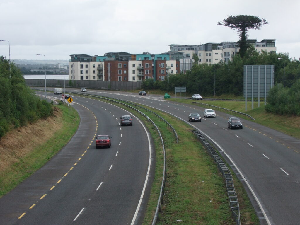
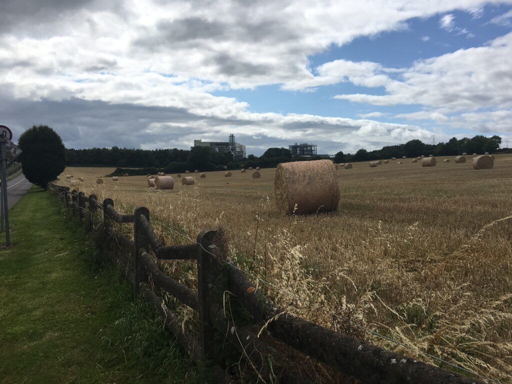
The road R618 provides a corridor from the heart of Inniscarra to Cork City. Looking at Inniscarra Reservoir from a distance is easy on the eye. The picture of the countryside rolls back along towards the Millstreet area. On closer inspection, one can see the effects of the Lee Hydro Electric Scheme of the 1950s. In particular, one can view the field systems on the south bank of Inniscarra Reservoir in Walshestown and Castleinch and see the edges of fields disappearing into the reservoir. It is like the area’s geography and history are being eroded over time by the lapping waters just like the memories of the place and the tide of time.
The Lee Scheme was constructed, it shaped and re-shaped the physical, vernacular, cultural identity and the social, political and economic landscapes of the valley. It also set a precedent in terms of future debates in science and technology in the region and changed human relationships with memory and the sense of place. Apart from the physical dam structures, the new reservoirs which emerged also provided a type of dark and watery cultural veil which covered 3,500 acres of land. A meandering and mature river was transformed into two large reservoirs, which at any time of year come across as dark, windswept, almost epic and secretive, colourful at times and difficult to access.
2. Ballincollig Regional Park

The interpretative panels in the Regional Park reveal that Ballincollig village remained a small community till 1794 when Charles Henry Leslie, a leading Cork merchant established the local gunpowder mills, a unique industrial complex in southern Ireland. In the early nineteenth century, it was one of three principal Royal Gunpowder Mills in the United Kingdom of Great Britain and Ireland. The other mills were at Waltham Abbey in Essex and Faversham in Kent. However, the mills at Ballincollig were constructed much later (1794) than the latter and hence the County Cork site was based on existing plans and technologies that had developed over many centuries. In Ballincollig a high stone wall enclosed 431 acres across which were various structures of buildings in which the various ingredients of gunpowder were made or mixed. The end result was a volatile product used to advance the British Empire from blasting rocks in mines to aiming to kill people on Britain’s international battlefields.
In 1810, an army barracks was built in Ballincollig to protect the supply of gunpowder. The outer perimeter stone walls extended from the eastern gate of the mills to Inniscarra Bridge. Ballincollig Barracks was located to the northern side of the Main Street in Ballincollig town centre. In the years following the end of the Napoleonic Wars the mills entered a period of quiet with a steep decline in staff numbers and production levels.
In the year 1888, the Ballincollig Gunpowder Mills were bought by John Briscoe and soon after came under the control of Curtis’s and Harvey. The mills closed in 1903 due to the advent of the production of dynamite. The Curtis and Harvey’s mills were then absorbed into Imperial Chemical Industries (ICI). The site was bought by Cork County Council in 1974, which developed it into a public park.
3. Lee Fields
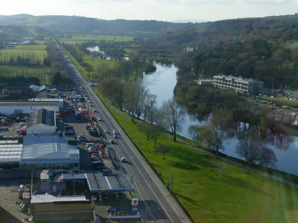
The weir at the Lee Fields provides a boundary of the River’s fresh water and tidal water. It is here that during all months that the die-hards swim in the Lee, where people walk their dogs, where fitness fanatics jog and stretch to couples discussing the day’s challenges or those who watch the waters flow. It is here that the River Lee splits into two creating a north and south channel, both channels encompass the city centre islands.
Different species of flora overhang the river as well as playful bird life dive for fish. The slow current but heavy volume of river water spills over the weir to meet the tidal water. The other view is of Cork’s and Ireland’s most impressive buildings such as the Waterworks, now the Lifetime Lab), the former Our Lady’s Hospital and Cork County Hall. Sites such as the Kingsley Hotel (formerly the site of the Lee Baths) and the new student accommodation are all located within view on the Lee fields and these reveal further insights into the past, present and future pulses of the city.
4. The Mardyke
Between 1720 and 1730, the area around the Mardyke was marshland and known generally as the West marshes. However, in 1719, a large section of land was bought by the town clerk Edward Webber who decided to build a raised walkway across the marshes as the step to reclaiming them. Edward Webber, himself was a descendant of a Dutch merchant. Consequently, he named his raised walkway after a promenade in Amsterdam called the ‘Meer-Dyke’, which means an embankment to protect the land from the sea.
In addition to constructing the walk Webber also built a tea house of red bricks which was the first of its kind in Cork. Fruit gardens and pathways of gravel were put down along with stone seats for the convenience of the public. The publicity of Webber’s tea house grew and soon it became a place, which people of high social status met. After the death of Edward in 1735, his tea house and gardens continued to prosper for over two centuries but eventually closed in the mid 1940’s. Between 1795 and 1850, the gardens and tea house were used as a summer residence for the Lord Mayor of Cork. At one stage people were employed to build an elegant pond and to take care of his grounds. In the early 1830’s people again started to use the walk. The renewed interest by the public led the Corporation to make the promenade more attractive by erecting a slate covered bandstand.
About 1845, the house which is presently the Municipal Museum was built by a prominent Cork family, the Beamishes. This family as well as William Crawford are also responsible for the setting up of Cork’s most famous distillery, Beamish and Crawford alot earlier in 1772. In 1867, the nuns of the Bons Secours (Sisters of Good Help) moved from their small overpopulated house on the Dyke parade and occupied the Beamish house. In those days, the majority of ill people were looked after in their homes or on the street as hospital care was very rare.
5. Fitzgerald’s Park
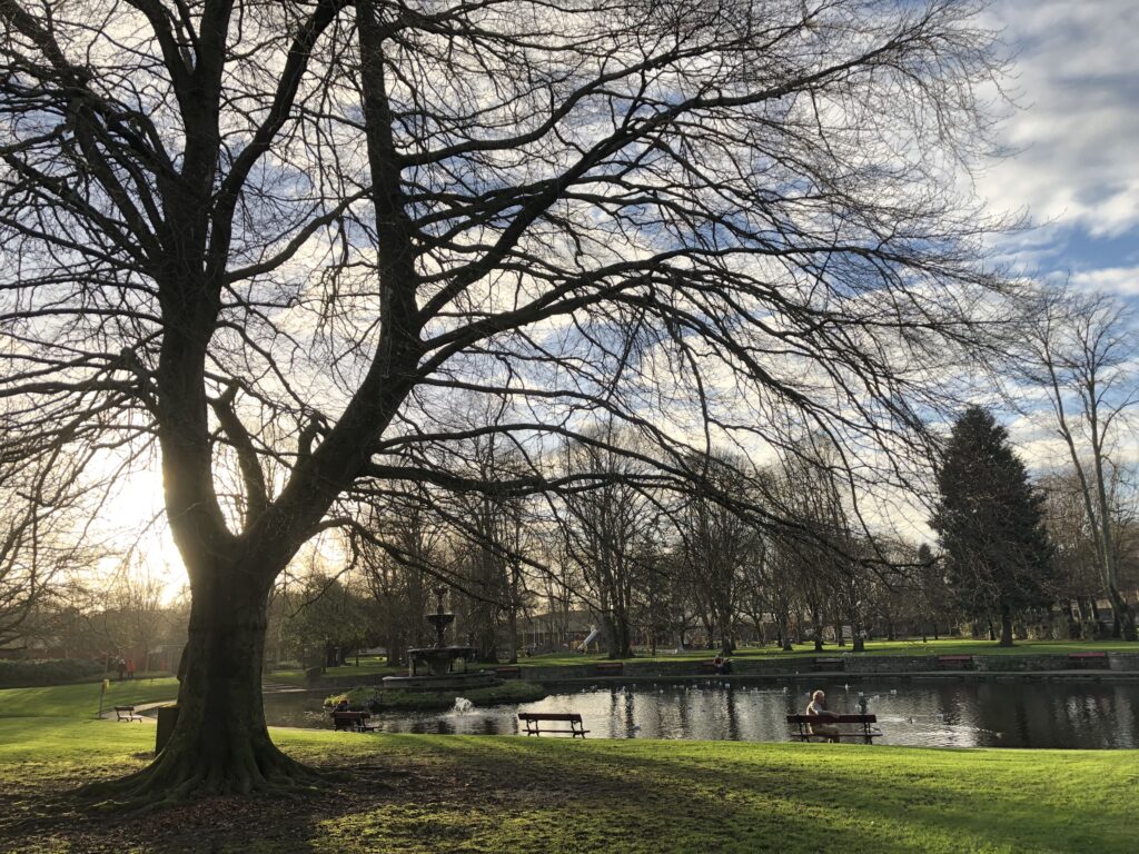
From May to November 1902, Cork City played host to one of the most significant events in its entire history – the International Exhibition of Manufactures, Arts, Products and Industries. It spanned a 44-acre site not far from the city centre encompassing an area on the Mardyke that now includes the Cork Cricket Club, the Sunday’s Well Boating and Tennis Club, Fitzgerald Park, and University’s Sports Arena. The exhibition grounds were elaborately laid out and had several large exhibiting halls and pavilions as well as an assortment of smaller buildings including tea houses, restaurants and kiosks. Irish and foreign exhibitors, some from ‘exotic’ locations such as China, Russia, and Turkey, filled these halls and pavilions with exhibits and demonstrations for all to see. The exhibition was visited by over a million people.
At the end of the Cork International Exhibition in 1903 in the Mardyke, the organisers wished to give the grounds to the people of Cork as a place of recreation. A decision was taken to name the new public space after Edward Fitzgerald, the organiser of the Exhibition and Lord Mayor of Cork from 1901 to 1903. A general Park Committee was agreed upon and established by the Exhibition committee. In March 1906, it was agreed to vest the Park and the Shrubberies House in the Corporation of Cork and Fitzgerald’s Park was born. Check out Cork City Museum, the former Exhibition Shrubberies House and also the park is the City’s official sculpture collection, home to a large collection in particular of Cork sculptor, Seamus Murphy.
6. Cork City
Cork possesses a north-west European and an eastern North Atlantic port story. Located in the south of Ireland, it is windswept by tail ends of North Atlantic storms, which consistently drench the city and rural areas with wind and rains – but they leave to showcase a very photogenic urbanity with amazing sunsets on the river channels and a resilient green agricultural hinterland and chiselled raw coastline. Cork’s former historic networks and contacts are reflected in its the physical urban fabric – its bricks, street layout and decaying timber wharfs. Inspired by other cities with similar trading partners, it forged its own unique take on port architecture.
The first known settlement at Cork began as a monastic centre in the seventh century, founded by St Finbarre. This is now marked by the late nineteenth structure of St Finbarre’s Cathedral. it stands tall proud in its ecclesiastical heritage and also imbuing the city and wider region with a need for community to bring people together and to invest physically and morally in such structures. Hence, Cork has a myriad of church buildings with different styles from different times when such buildings were called upon to impart new messages about their contribution to the city.
The main urban centre was built on a series of marshy islands at the lowest crossing-point of the river, where it meets the sea. One can imagine the timber posts struck into the marshland to mark out the tentative first couple of Viking houses, and the first fires lit in such flood prone structures. The Vikings were the first to develop a basic bridge spanning from the valley side to the marsh, now marked by South Gate Bridge. This was the start of a rich maritime history and a strong identification as a port town.
The laying of the first block of the Anglo-Norman town wall must have been equally momentous. The actual stone from beneath the encircling southern and northern hills – sandstone and limestone provided the defences. The creeking open for the first time of Watergate and the control by the King’s and Queen’s Castles would have sparked excitement especially as the first timber ship clocked against the key walls. Similarly, the first ship from somewhere abroad in England or France would have brought a sense of wonder and acknowledgment in the city’s role in maritime western Europe.
The topping out of St Anne’s Church Shandon and years later the addition of the bells and clocks would have met with delight and pride. From the top of Shandon, you can gaze down upon the multi-coloured fabric and multi-faceted narrative presented in its urban fabric.
7. The Marina
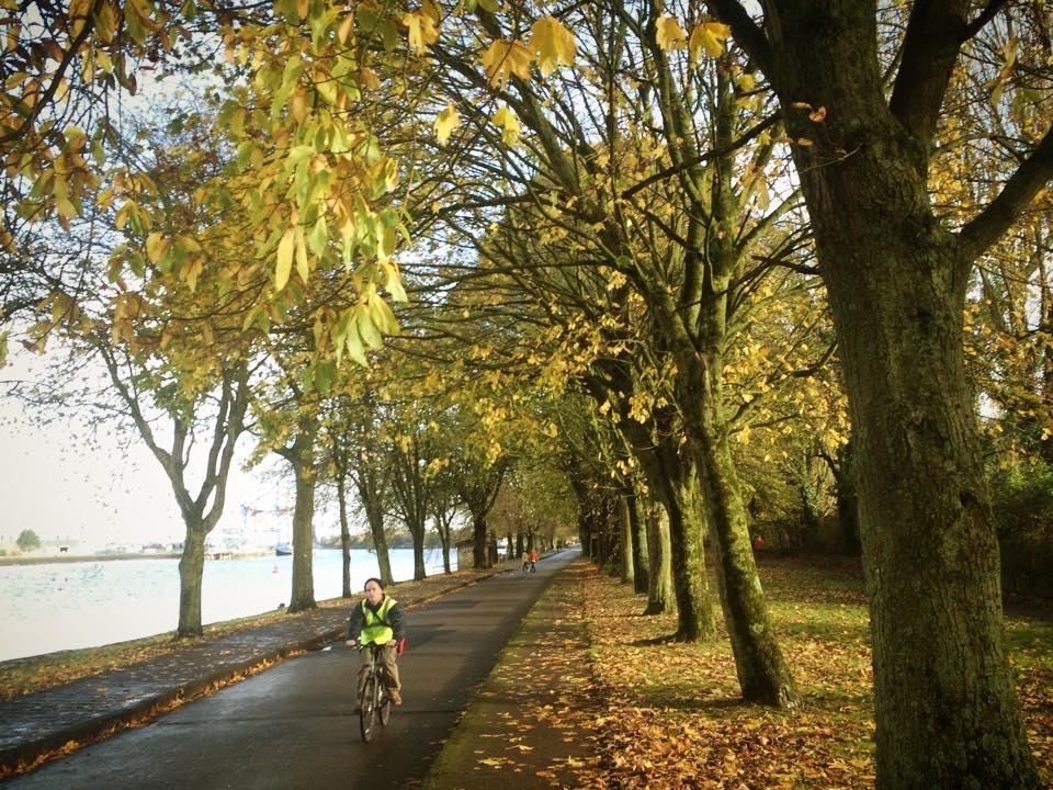
Cork’s Marina, originally called the Navigation Wall, was completed in 1761. In 1820, Cork Harbour Commissioners formed and purchased a locally built dredger. The dredger deposited the silt from the river into wooden barges, which were then towed ashore. The silt was re-deposited behind the Navigation Wall. During the Great Famine, deepening of the river created jobs for 1,000 men who worked on creating the Navigation Wall’s road – The Marina. The environs is also home to three rowing clubs – the Lee Rowing Club founded in 1850, which is the second oldest club in the country; Shandon Boat Club, founded in 1875, and Cork Boat Club founded in 1899 by members of Dolphin Swimming Club – all of which ply the waters of the river regularly and who have annual regattas.
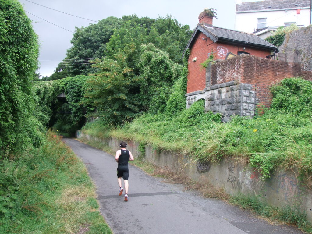
8. Cork Blackrock & Passage Railway Line
The year 1836 marked the opening of Ireland’s first railway, between Dublin and Kingstown. A year earlier in 1835, the plan for a Cork to Passage railway was first proposed by Cork based merchant, William Parker and Cork solicitor, J C Besnard. In that year, Cork Harbour town Passage West had its own dockyard and had become an important port for large deep-sea sailing ships whose cargoes were then transhipped into smaller vessels for the journey up-river to the city. The transhipment would be faster by train. In the summer of 1835 a committee was set up to plan the railway. The Cork Harbour Board, the British Treasury and other bodies were approached for financial support.
Charles Vignoles was appointed engineer of the venture. The proposed line would run close to the south of the Navigation Wall (now the site of the Marina) on reclaimed land and remain close to the river to Passage. Work began in June 1847. Due to the fact that the construction was taking place during the Great Famine, there was no shortage of labour. The entire length of track between Cork and Passage was in place by April 1850 and within two months, the line was opened for passenger traffic.
The terminus, designed by Sir John Benson, was based on Victoria Road but due to poor press was moved in 1873 to Hibernian Road. By 1932, the increase in the use of motor cars caused a decrease in the use of the line by passenger. Consequently, the railway was forced to close. Much of the traces of the Cork-Blackrock line have been destroyed while the Blackrock-Passage section is now a pedestrian walkway with several platforms and the steel viaduct that crossed the Douglas viaduct still in public view. The site of the second Cork terminus lies opposite the National Sculpture Factory.
9. Lakelands
At one time approximately 50 mansions in the south-eastern suburbs of Cork City overlooked Douglas Estuary and Cork Harbour. One of the largest was that of Lakelands, owned by the Crawford family. By 1792 William Crawford had moved from County Down to Cork where he co-founded of the successful Beamish and Crawford brewery. He occupied the fine and large residence Lakelands at Blackrock, to the east of the city overlooking the widening River Lee. His son, William Crawford (Junior), continued his involvement with the brewery, but was also active in the cultural life of Cork City. He was one of the founders of the Crawford School of Art of which his son, William Horatio, was a generous benefactor.
From 1890s to 1940s, Lakelands was allowed decay and is now occupied by a regional road and apartment complex whilst the core of the former estate is marked by Mahon Shopping Centre. In 2003 preparation works for Mahon Point Shopping Centre complex revealed several features from the Lakelands estate. Two access roads, a quay, and a number of garden features such as its icehouse, cellar and walled gardens.
10. Rochestown
In 1372, in an inspection of the dower of Johanna, widow of John de Rocheford, there is a reference to allotments of land to her in Douglas. The Roches originally came from Flanders, then emigrated to Pembrokeshire in Wales, before three of the family – David, Adam and Henry de la Roch – joined Strongbow in the Anglo-Norman invasion of Ireland in the twelfth century. In all there are sixteen Rochestowns in Ireland and innumerable Roche castles.
11. Passage West
With the establishment of a dock and ship-yard in Passage West in the nineteenth century, many merchants became ship-owners, and carried on an extensive trade in their own vessels. Three of these individuals were well known entrepreneurs, William Parker (who engaged in foreign speculations in shipping) and Thomas Parsons Boland and the Brown family. William Brown’s dockyard was going from strength to strength, offering invaluable employment to the people of Passage West and much further afield. Workers used to board the Cork Blackrock and Passage Railway at Cork to come to the dockyard in Passage West.
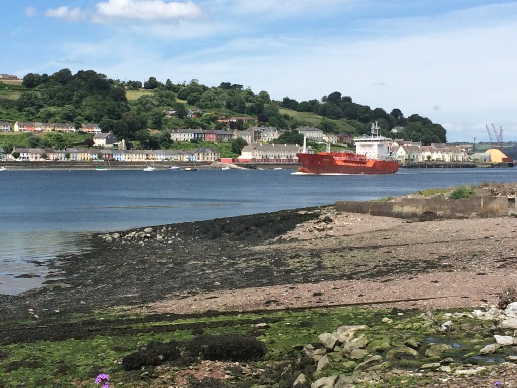
In 1849, when Queen Victoria was visiting Cork Harbour, the Browns were given official permission to name their concern the Royal Victoria Dockyard. The Royal Victoria Dockyard was described a “most spirited and extensive undertaking probably ever attempted in Ireland by individual enterprise. Established in 1832, twenty years later it comprised two dry docks, employed over 300 people who ran sailing and rigging lofts, workshops, stores, a steam sawmill and repaired up to 200 ships a year. Much employment was also afforded to labourers involved in discharging cargoes of all large vessels bound for Cork, the river up to Cork was not navigable for those above 400 or 500 tons’ burden. By the 1870s, staff had increased to 700 and a 4-storey granary was built on the site. With the dredging of the river of Cork and the demise of timber ships, the fortunes of the Dockyard began to decline towards the end of the nineteenth century. It struggled on until 1931 when the plant and equipment was auctioned off.
12. Monkstown
Monkstown derives its name from a small establishment of Benedictine monks, called Legan Abbey, belonging to the priory of St John’s, Waterford. They formed a branch in Cork Harbour in the fourteenth century, on a grant of land made to the original establishment by the family of McCarthy.
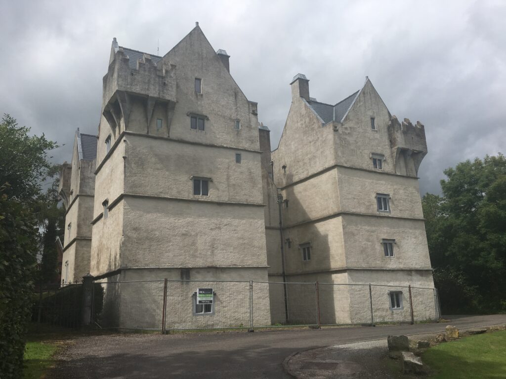
Located at the side of a steep glen overlooking the inner harbour, the entrance to Monkstown Castle was near the old Monkstown-Cork road. Circa 1636, according to legend, the lady who built Monkstown castle for 4d was Anastasia Archdeacon wife of John Archdeacon, a member of an Anglo-Irish family. Anastasia’s maiden name was Gould. She was a member of an old walled town of Cork family who were merchant princes. While he was serving abroad she was tasked with her husband’s sum of money to oversee the construction of a new castle for the couple. Local folklore relates that having assembled her workmen, she carefully chose her supply of provisions, materials and other necessities. When the castle was completed, and her accounts made up, she discovered that all she was out of pocket was the sum of one groat (4d).
13. Ringaskiddy
From 1960, modern Cork Harbour began to emerge, with the construction of oil terminals, steel mills, shipyards, deep water ferry port and industrial base. The entire concept of transporting general cargo underwent radical changes with the introduction of containerisation. That brought about revolutionary changes in ports. Whereas previously the only requirements of general cargo services were quays and adjoining transit sheds, the ports now had to provide quays with high load-bearing qualities and wide aprons, specialised container cranes, large marshalling areas for containers and further specialised handling machinery within the container compounds. At Tivoli Industrial and Dock Estate new facilities included new container, roll-on roll-off and conventional berths, a 30-ton gantry-type container crane, a modern transit shed, a passenger terminal and office block and an extensive paved area for the marshalling of containers and commercial vehicles. Thirty-seven acres were allocated for general cargo purposes.
Cork was the first port in Ireland to set up a planning and development department. By 1972 this produced the Cork Harbour Development Plan in which a blueprint was designed for a future which would include sites such as that at Ringaskiddy, Little Island, and Cobh areas.By the middle of the present decade, employment in these industries is likely to exceed 5,000 people and the port’s frequent shipping services are an important factor in attracting new industries.
14. Carrigaline
Carrigaline is part of the ancient Irish territory of Ciarridhe-Cuirrche, which is modernised into the present barony of Kerricurrihy. This district must have been intensely populated from a very early period, as every townland in it is studded with ringfort earthworks variously known as ‘rath’, ‘dun’, and ‘lios’. Carrigaline in early times was called Beavor, or Bebhor, and derived its name from the abrupt rocky cliff on which are the remains of the ancient castle. It was built by Miles de Cogan, and for nearly two centuries occupied by the Earls of Desmond. By the nineteenth century, the village consisted of several houses and cottages, extending into the parish of Kilmoney, on the south side of the river, over which is a bridge of three arches.
The first recorded church in Carrigaline was Cill na gClearach, the Church of the Clerics, from which the townland of Kilnagleary derives its name. This church dated from the seventh century AD and the monks who founded it were most likely associated with St Finbarr’s monastery in Cork. It is from here that the Carrigaline-Crosshaven walkway begins.
15. Drake’s Pool
An eighteenth-century visitor to the Carrigaline area was Dr Charles Smith, who compiled a history of Cork (published in 1750). In his book is the first mention of the story concerning English Admiral Francis Drake: He wrote that Sir Drake in 1589 with a small squadron of five ships of war, was chased into Cork harbour by a fleet of Spaniard galleons. He sailed into Crosshaven and moored his ships behind the shelter of Currabinny Hill in a safe basin. The Spaniards sailed up the harbour of Cork and were surprised not to see the ships they had just before chased into it. Hence having missed their prey, they came out again. Charles Smith refers to the hiding place as Drake’s Pool. The name was supplied by later writers. It is not mentioned in any source previous to 1750, or in the accounts of Drake’s movements.
16. Crosshaven
Old Point represents the probable site of the first Anglo-Norman settlement at Crosshaven in the thirteenth century. There was a small village protected by a castle and linked with a larger manor in Carrigaline. Crosshaven took its name from a cross erected in honour of St John near the settlement. Crosson is the earliest written form of the name (1301). In the year 1307 AD a law case highlights that Thomas le Husser of Crosshoun was summoned by Richard Heruy and Adam Grousmound, executors of Adam Henry’s will, on a plea of a debt that was owed. Fast forward in time and Castle Point was an embarkation space called the Old Quay in the nineteenth century. In addition, the Castle Point village comprised of 21 houses. Today, the Old Point settlement is built upon by modern housing and the Crosshaven boatyard, which provides much employment. On 15 December 2007, local historian Diarmuid Ó Mhurcadha did the honours of unveiling of a commemorate plaque near the alleged site of the castle.
In 1769, William Hayes undertook the building of the present Crosshaven House, a handsome limestone structure. Presumably, the old house was then demolished. Built in the Palladian style, this fine cut limestone ashlar building has a 3-storey central block with two detached pavilions to the east and west. Although the house was built in 1750, it remained unoccupied until the early nineteenth century so all joinery and decorative features date from after 1800. Thomas Hayes of Crosshaven was the owner of almost 1,600 acres in county Cork in the 1870s. Over 1,000 acres of his estate in the baronies of Kinalea and Kerrycurrihy were offered for sale in the Landed Estates Court in October 1872. It remained in the ownership of the Hayes family until the 1960s. Crosshaven House was sold by Colonel Pierce Hayes to an American Graham Flint in the late 1960s. In the mid-1970s the latter sold it to Crosshaven Development Committee, which converted the building into a community centre. In recent years the house was meticulously restored to its former glory is open to the public. Spacious and elegant reception rooms are complimented by the five separate suites on the upper floors. The space also caters equally well for wedding parties, corporate events or private hire.